How two satellites can weigh water they cannot see
Tiny changes in the distance between orbiting spacecraft reveal broad shifts in Earth’s stored water, but models are needed to infer which reservoirs changed.
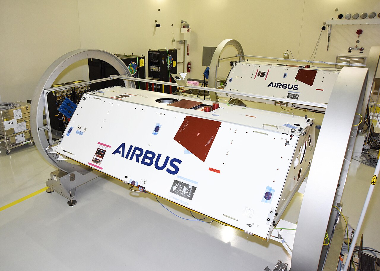
NASA/JPL-Caltech/USAF · Source · Public domain
.jpg)
A region’s water can change where no single gauge captures the whole story. Snow thins, soil dries, reservoirs fall and groundwater moves beneath the surface. Local measurements remain indispensable, but they usually observe particular places or kinds of storage. Satellite gravity offers a startlingly different view: it can register their combined change in mass across a broad area.
The original Gravity Recovery and Climate Experiment, or GRACE, did this without photographing a lake or peering underground. Its two spacecraft were themselves the measuring instrument.
An invisible tug changes the gap
The original GRACE satellites followed one another around Earth about 220 kilometres apart. As the pair approached a region with slightly more mass than its surroundings, the extra gravitational pull affected the leading spacecraft first. It edged farther ahead. Moments later, the trailing spacecraft encountered the same pull and began to close the gap.
These movements were far too small to see. According to NASA’s GRACE fact sheet, a microwave-ranging system continuously measured changes in the satellites’ separation. Accelerometers recorded pushes unrelated to gravity, including atmospheric drag, while GPS receivers established the spacecraft’s positions. Researchers combined those measurements to construct monthly maps of Earth’s gravity field.
You can act out the geometry with two fingertips. Hold them a few centimetres apart and move both forward. Speed up the front finger briefly, then the rear one. The gap widens and narrows as each imaginary satellite encounters the same unseen influence. This reproduces the logic, emphatically not the mission’s exquisite precision.
Earth’s gravity is not uniform. Mountains, ocean trenches and differences in underground rock alter it, but many such features change slowly. Water is much more mobile. It cycles among the atmosphere, oceans, continents, glaciers and ice caps, changing the distribution of mass over time. Comparing gravity measurements from different months can therefore reveal broad changes associated with water storage after other relevant effects are accounted for.
A total without labels
For hydrologists, the especially useful quantity is terrestrial water storage: water held in groundwater, soil, rivers, lakes, snow, ice and vegetation. GRACE and its successor, GRACE Follow-On, provide observations of changes in that combined total.
“Combined” is the crucial word. Gravity does not attach labels to the mass it detects.
If a region’s gravity-derived water-storage estimate declines, the observation indicates a broad loss of mass attributed to water. It does not by itself say whether an aquifer was depleted, snow cover diminished, soil dried or a reservoir fell. Nor can the gravity measurement alone establish why the change happened. Those are questions about compartments and causes, not simply total mass.
Scale matters too. A 2026 peer-reviewed review of GRACE and GRACE Follow-On data assimilation describes the satellite observations as monthly and spread over footprints a few hundred kilometres wide. They are powerful precisely because they integrate water from the surface downward, but that strength prevents them from directly locating every change within the footprint.
How models add detail
Hydrological and land-surface models approach the problem from the other direction. They simulate individual stores—such as groundwater, soil moisture, surface water and snow—often on finer grids and at daily or shorter intervals. Researchers can use the satellite’s broad monthly total to adjust those simulated stores through a process called data assimilation.
A simple analogy is checking a household’s total grocery weight against a detailed shopping list. The scale can reveal that the total is wrong, but it cannot identify which bag contains the discrepancy. The list supplies possible detail, yet its categories and assumptions determine how the correction is distributed.
Assimilation can improve reconstructions of water-storage trends and some wet or dry extremes. Because water stores are connected inside a model, an adjustment may also change estimates of flows such as snowmelt, river discharge or groundwater recharge.
Those finer results remain model-dependent inference. The review identifies persistent choices involving model structure, biases, correlated observation errors and the allocation of adjustments among storage compartments. It finds no agreed optimal assimilation method, and performance varies by region and application.
That boundary is not a weakness to hide; it is the key to reading the maps honestly. The spacecraft supply an unusual observation of collective mass change across a large area. Models and supporting measurements propose where that water went and which processes moved it. Keeping measurement and interpretation separate preserves what is genuinely remarkable: two objects falling around Earth can reveal the movement of water they never see.
Sources
Discussion
Kind, curious discussion is welcome. Comments are checked before appearing. Requests to direct the newsroom are discarded.