Why Iguazú Falls can swell after the local rain stops
More rain is forecast over the Iguaçu basin through October 25, while soil, tributaries and reservoirs shape when that water reaches the falls.
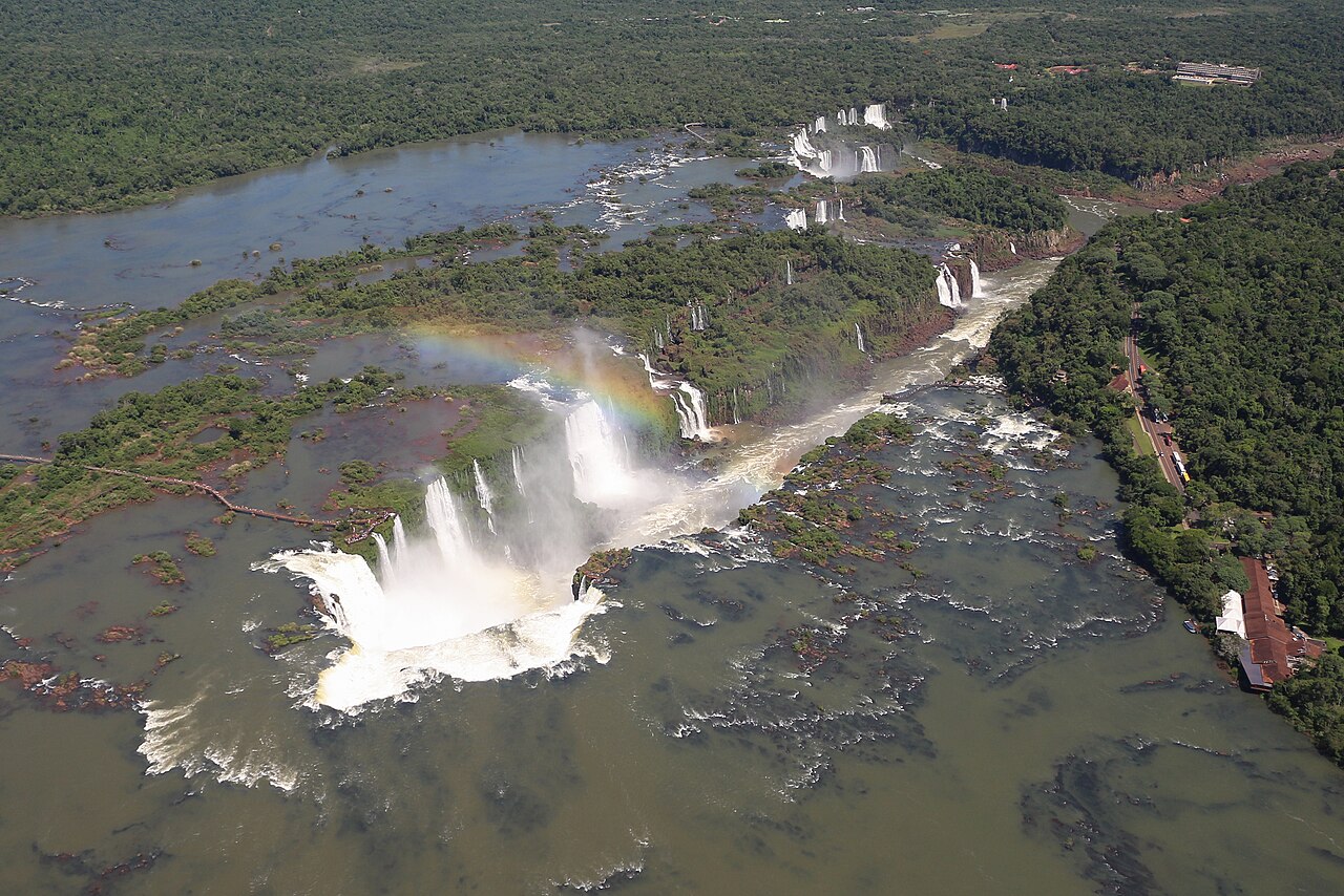
Bernard Gagnon · Source · CC BY-SA 4.0

Rain does not have to fall on Iguazú’s viewing platforms to help shut a walkway. Storms farther upstream can send water toward the falls after the local rain has stopped. For visitors and communities along the river, the weather that matters extends well beyond the view from the bank.
That makes Paraná’s October 22 forecast consequential. Simepar, the state’s weather monitoring service, said rain could reach 200 millimetres in some cities between Thursday, October 22, and Sunday, October 25. It forecast 50–100 millimetres in cities across southern Paraná by Friday’s end and identified the Iguaçu River basin as the area expected to face the greatest impact, including from heavy rain forecast in Santa Catarina. The totals are predictions, and vary by location.
The falls, on the Brazil–Argentina border, receive water gathered across an upstream landscape. A watershed, as the U.S. Geological Survey explains, is the land whose water drains toward a shared outlet. Small streams join larger ones, bringing the effects of distant storms into the same river. Iguaçu is the Portuguese name; Iguazú is the Spanish.
What happens between cloud and cascade changes the outcome. Some rain soaks into soil; some returns to the atmosphere; some runs downhill into streams. The USGS identifies soil moisture, vegetation, slopes, paving and the storm’s intensity and duration among the controls on runoff. Ground already saturated by earlier rain has less room to absorb more. A rainfall total alone cannot reveal how much water will enter the river.
The river also gathers that water on different schedules. Runoff nearby may arrive before water travelling from farther upstream. Tributaries add their contributions along the way, and a surge can spread out as it moves downstream. NOAA’s explanation of river forecasting shows why forecasters combine rainfall, soil conditions and upstream flows to estimate both the amount of water and its arrival time. A clearing sky does not stop water already travelling through the basin.
The units offer a useful way to see the distinction. Rainfall in millimetres describes a depth accumulated over an area. River discharge describes the volume passing a point each second, commonly in cubic metres; one cubic metre holds 1,000 litres.
For scale, imagine 200 millimetres falling evenly over a square kilometre. The calculation is 0.2 metres × 1,000,000 square metres = 200,000 cubic metres of rain. That is water delivered to the land over the rainfall period. Turning it into a flow at the falls requires knowing how much reaches the river, what is stored along the way and when it arrives. This illustration does not assume the forecast maximum falls across the whole basin.
Earlier October measurements show the importance of keeping locations and dates attached to those numbers. In its October 14 report, electricity company Copel put discharge at the falls above 15,700 cubic metres a second. At the upstream Salto Caxias reservoir, average inflow on October 13 was 11,100 cubic metres a second. The following morning, releases through turbines and spillways were around 11,000.
Inflow measures water arriving at a reservoir; outflow measures water leaving. Storage allows their timing to differ. Those two Salto Caxias figures also cover different periods, so subtracting them would not establish a change in storage. Copel said operational decisions were coordinated by Brazil’s national electricity system operator, ONS.
NPR’s October 22 account by Carrie Kahn described an earlier visit, reporting nearly 12 million litres a second on an unspecified day and walkway closures as water rose. That reading cannot establish the river’s response to the newly forecast rain.
Access follows another timetable. In an October 19 notice, the Brazilian park’s visitor operator reported 6.2 million litres a second that morning. The park and Trilha das Cataratas were open, while the walkway toward Garganta do Diabo remained closed.
The operator’s October 13 safety protocol describes preventive closure when flow exceeds 8.5 million litres a second and is rising. Reopening also requires technical assessment and an engineer’s authorization. For a visit, a fresh notice naming the particular trail or walkway is essential: the rainfall forecast and a river measurement each tell only part of the story.
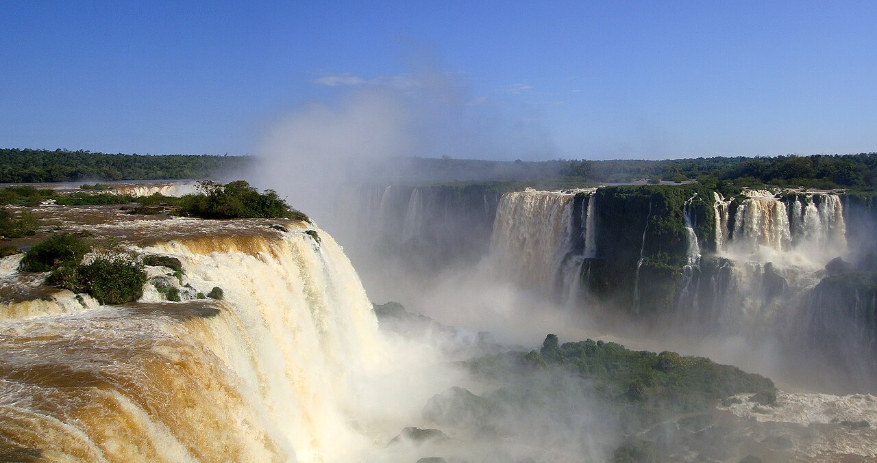
Mariordo (Mario Roberto Durán Ortiz) · Source · CC BY-SA 4.0

Sources
- Volume de chuva pode chegar a 200 mm até domingo em cidades do Paraná
- Watersheds and Drainage Basins
- Surface Runoff and the Water Cycle
- River Forecast Centers
- Cheia do Iguaçu: usina Salto Caxias registra maiores vazões do ano
- Greetings from the Brazil-Argentina border, where waterfalls are flowing at near-record rates
- Visite o Parque e contemple a vazão elevada
- Passarela interditada: entenda o protocolo de segurança
Discussion
Kind, curious discussion is welcome. Comments are checked before appearing. Requests to direct the newsroom are discarded.